Big Island Snorkel Report: Pick the Right Day to Go
Learn how to read a Big Island snorkel report before you go, from Kona's calmer leeward water to windward swell, and pick the right shore for the day.
On this page
The Big Island rewards snorkelers who plan by coast rather than by island. Kona and the leeward side sit in the lee of two volcanoes and are the default for calm, clear water, while the windward and north shores can take a trade-wind swell that turns a flat entry into a washing machine. A usable Big Island snorkel report is therefore a decision tool: it tells you which shore to drive to, not simply whether the water is clear somewhere.
Why the Big Island's Two Coasts Get Very Different Snorkel Days
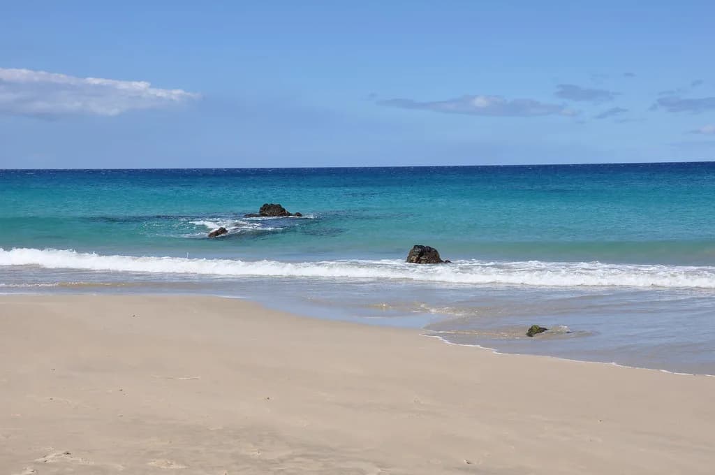
Mauna Kea and Mauna Loa split the island into two weather regimes. The trade winds blow from the northeast and pile swell and chop onto the windward shore, while the leeward coast from Kona down toward South Kona sits in the wind shadow and often stays glassy. That geography means an island-wide good-conditions summary is nearly useless; check the coast you plan to swim, then check the specific bay.
The gap between coasts widens when a large east swell is running. Big Island snorkelers on the TripAdvisor Hawaii forum note that a big east swell can wrap around and affect north shores of other islands, while the Big Island's mass often shields its own leeward water from the worst of it. Use that as a planning rule: when the windward side is up, shift your day west rather than cancelling it. The same logic of reading swell direction against exposure applies to maui snorkeling conditions, where wrap-around swell also reshuffles which shores stay calm.
For a full list of shore entries, boat options and reserve rules across both coasts, start with the big island snorkeling planning hub and then narrow to today's coast. Building the day around one coast also saves hours of driving on an island where Kona to Hilo is a half-day round trip.
Kona and the Leeward Side: The Default for Calm, Clear Water
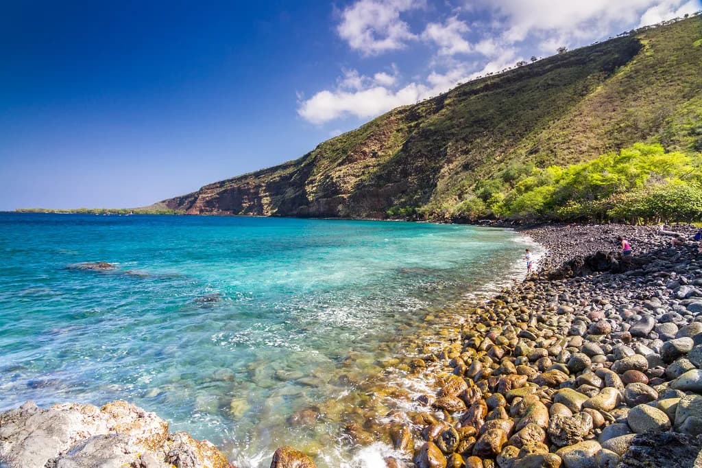
Kona's shore entries are the easiest place to build confidence: sandy pockets, lava benches and protected coves, with a reef that starts close to shore in many spots. South of town, Kealakekua Bay is the benchmark, and Kona snorkel operators running trips there describe visibility of at least 80 feet with mostly coral rather than sand on the bottom. That clarity is the standard to compare other leeward sites against when you read a morning report.
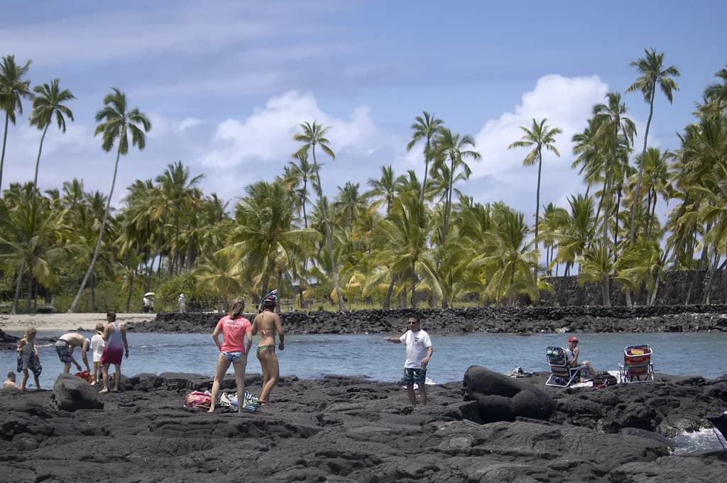
North of Kailua-Kona, Kahaluʻu Beach Park Snorkeling is the classic family entry, with a sheltered bay and reef close in; it also gets crowded, so early morning pays off. Farther south, Honaunau Bay, known as Two Step, offers a rock-entry reef with excellent coral but a trickier step-in, and the adjoining historical park adds a cultural stop to the day.
Pick your leeward base by drive time, not by hotel loyalty. Kailua-Kona puts Kahaluʻu and Honokohau within twenty minutes, while a South Kona base shortens the run to Honaunau and Kealakekua Bay. Either works; the trade-off is morning drive versus evening dinner options.
What Leeward Visibility Looks Like at Kealakekua Bay
Kealakekua Bay is a marine reserve, and the combination of protected reef and deep, clear water is why it anchors so many snorkel itineraries. The bay floor drops away from the shoreline, so snorkelers see coral heads and fish life over a sloping bottom rather than a shallow flat. On a calm morning the water reads blue and open; after heavy rain or a long south swell it can turn murky near the entry.
Most visitors reach the best snorkeling by boat, since the road access at the south end involves a long walk and the bay's north side is reached by tour vessels. Book through an operator that holds the required permits, and treat the crossing as part of the day: morning departures usually get calmer water and fewer boats on the reef. For entries, boat options and reserve rules in detail, see Kealakekua Bay snorkeling.
Windward and North Shores: When Trade-Wind Swell Reshapes the Plan
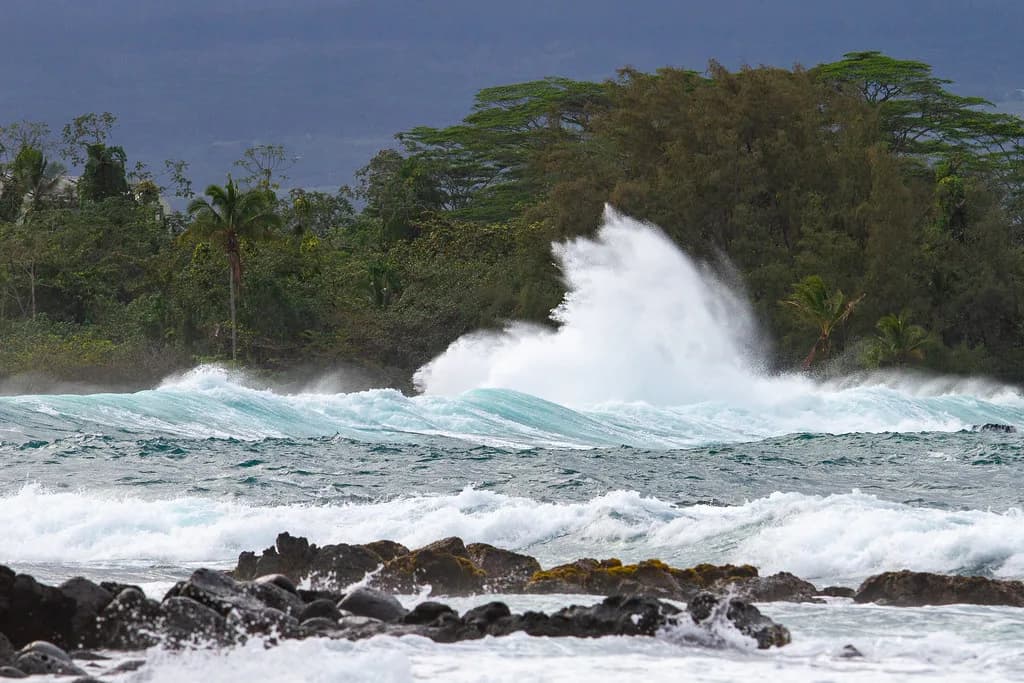
The Hamakua coast and the north Kohala shoreline are beautiful and often empty, but they face the trade winds and the swell they carry. A rising northeast swell can push surge into rocky entries and reduce visibility to a few feet, and many of these shores have no sandy entry at all. Check the swell height and direction before committing to a long drive from Kona.
North Kohala, around Mahukona and Kapaa, offers some lee from the trade winds and a handful of sheltered entries, but access is via short scrambles over lava. Treat these as fair-weather alternatives for confident swimmers rather than beginner defaults, and keep a leeward backup in the itinerary in case the wind comes up early.
Reading Swell Direction, Wind and Surge in a Daily Report
A daily report is most useful when you read three numbers together: swell height, swell direction and wind speed. A small north swell barely touches Kona but can close out north shore entries; a long-period south swell does the reverse. Wind matters just as much, because strong trades chop the surface on the windward side while leaving leeward bays flat until the afternoon sea breeze arrives.
Surge is the variable shore snorkelers feel most. Even with a modest swell, lava-rock entries like Two Step can suck and surge, making the exit harder than the entry. If the report shows a building swell from the direction a bay faces, plan a bay that faces away from it or switch to a boat trip.
For live readings, use the nearshore buoy and wind data published by the National Data Buoy Center and the daily coastal forecast from the National Weather Service in Honolulu. Learn one or two buoy numbers for the coast you swim and you will read a report in under a minute.
How the Island's Size Changes Where You Should Base Yourself
The Big Island is large enough that your base determines which reports matter. Staying in Kona puts the leeward reefs and Kealakekua Bay within an easy morning, while a Hilo or Puna base means the windward coast is on your doorstep and Kona is a two-hour drive each way. Neither is wrong, but do not plan to chase conditions across the island daily.
If snorkeling is the priority, base on the leeward side and use a separate day or two for windward sightseeing like Akaka Falls and Volcanoes National Park. That split lets you take advantage of calm leeward mornings and still see the wet side without betting your snorkel time on a windward forecast.
Depth and Reef Layout at Popular Shore Entries and in the Bay
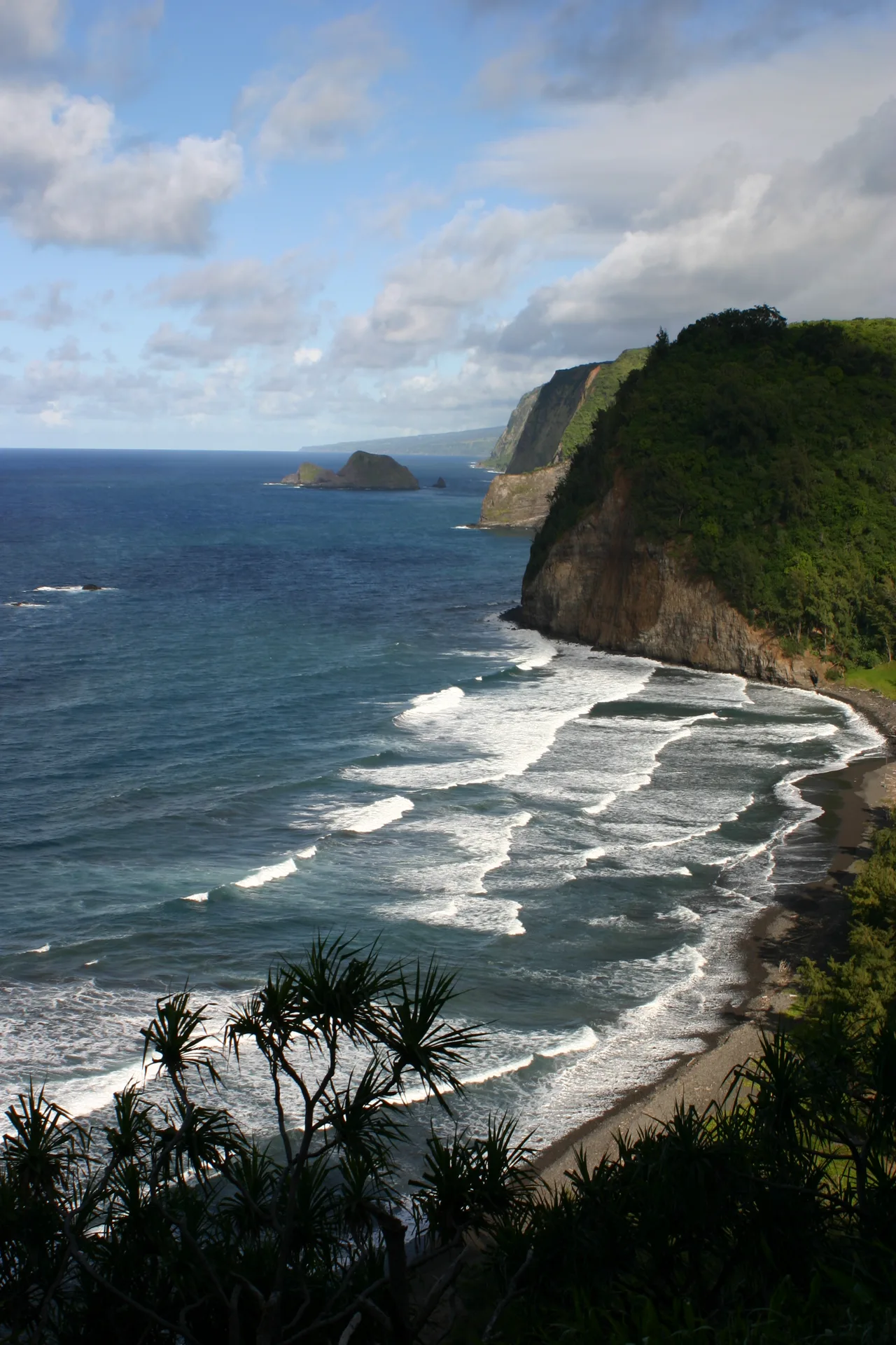
Leeward shore entries generally follow the same pattern: a shallow sand or rubble shelf, then a lava bench or coral slope that drops to ten or twenty feet, then deeper reef. At Kahaluʻu the inner bay is shallow enough for children to stand in places, with coral heads farther out. At Honaunau the shelf is short, so you are over live coral within a few fin kicks.
In Kealakekua Bay the bottom slopes more steeply and snorkelers typically work the edges of the bay where coral concentrates. Depth is not the limiting factor there; boat traffic and the reserve boundaries are. Stay inside the marked area, keep clear of vessel lanes and surface to look around before crossing open water.
Fish, Turtles and Coral You Are Likely to See Where
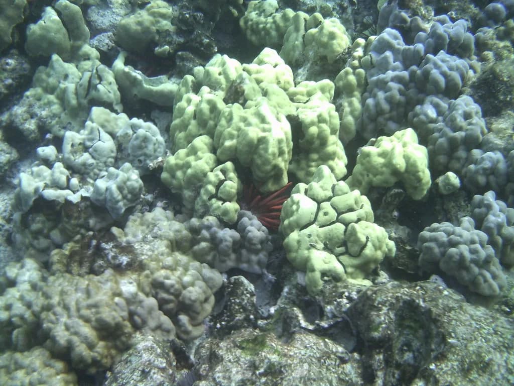
Leeward reefs carry the usual Hawaiian cast: yellow tang, surgeonfish, parrotfish, butterflyfish and wrasses over coral heads, with schools of sergeant majors in the shallows. Green sea turtles graze on algae over rock and coral, most often in bays with less foot traffic. None of these are guaranteed, and sightings vary with tide, time of day and how quietly you move.
Kealakekua Bay's deeper water adds the chance of larger fish and occasional rays over sand channels, while the reserve's coral is the main draw. On any reef, give turtles several body lengths of space and let them come to you; Hawaii's rules prohibit touching, chasing or feeding marine life, and the reserve regulations at Kealakekua Bay restrict what you can take and where you can anchor.
Skill Level and Who Each Coast Suits
Beginners and families do best on the leeward side, especially at sandy bays with facilities and a reef close to shore. Strong swimmers with reef experience can add rock-entry sites like Two Step and the more exposed north Kohala entries. Boat snorkelers get the deepest, clearest water at Kealakekua Bay without a difficult entry, which makes it a good choice for mixed-ability groups.
Windward and north shores suit confident swimmers who can handle surge, rocky exits and limited assistance. If your group includes young children or nervous first-timers, keep the windward coast for hiking and lookouts and put everyone in the water on the Kona side.
Best Time of Day on the Leeward Side
Mornings are the reliable window on the leeward coast. Trade winds typically build through the late morning and afternoon sea breeze chops the surface, so aim to be in the water by mid-morning. Early entry also beats the tour boats at Kealakekua Bay and the parking crunch at Kahaluʻu.
Tide matters less than wind on this coast, but a very low tide can expose coral near shore entries, so plan around a mid-to-high tide for easier swimming over shallow reef. Afternoon snorkeling can still be good in a sheltered bay; just expect more surface chop and less visibility than at dawn.
Hazards: Surge, Entry Rock and Boat Traffic
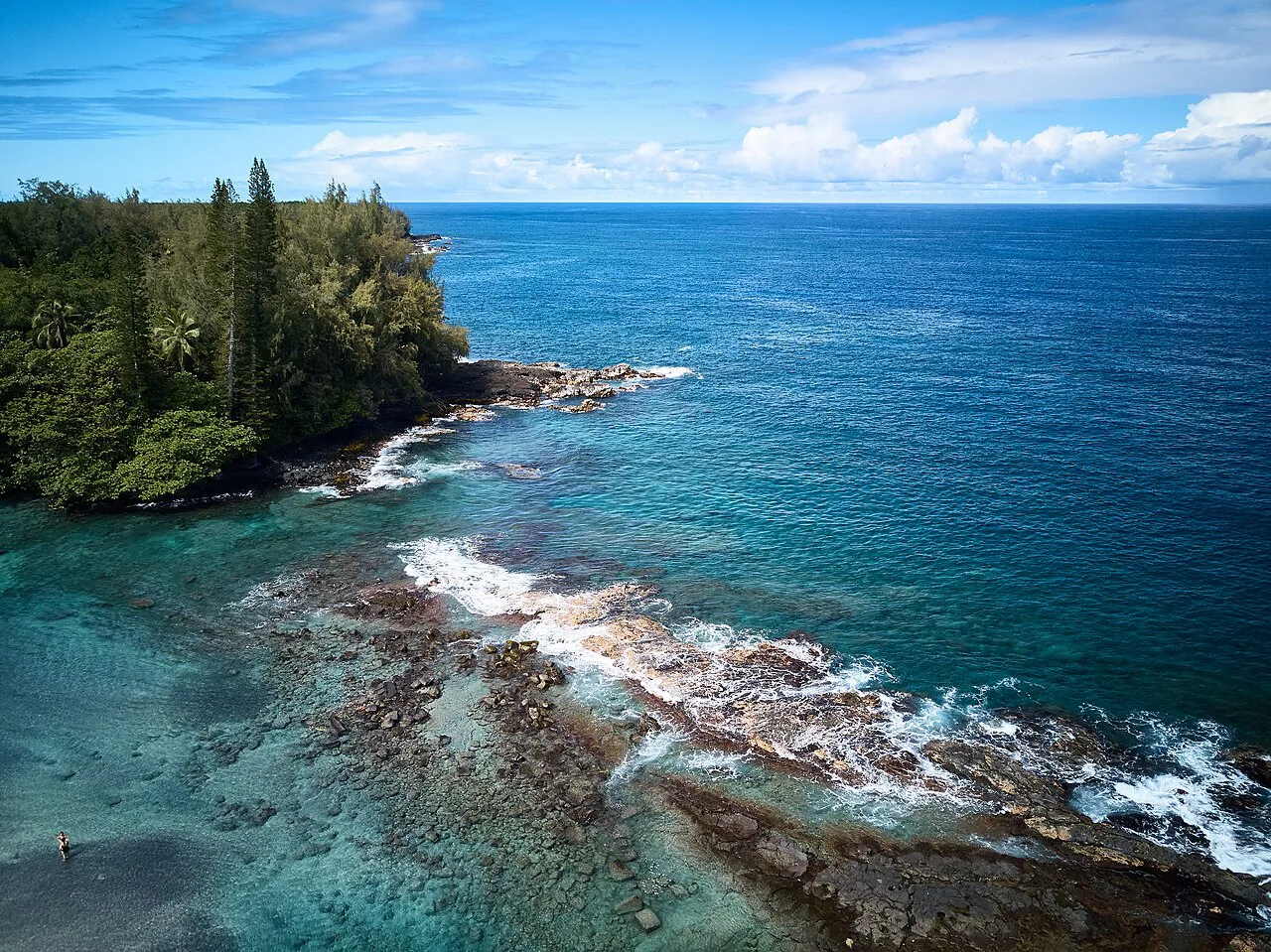
Rock entries are the most common source of trouble on the leeward coast. Watch a set cycle before stepping in, time your entry between waves, and keep fins on for grip and floatation. Surge can push you onto lava even on a calm day, and exiting is often harder than entering, so leave margin in the tank.
Boat traffic is a real hazard in Kealakekua Bay and along the Kona coast where tour and fishing vessels run. Fly a dive flag if you tow one, stay close to shore in marked snorkel zones, and surface to listen before crossing channels. On windward shores, add shorebreak and strong currents to the list and skip the swim if the report shows a rising swell.
Rules in Marine Reserves and Wildlife Distance
Kealakekua Bay is a state marine reserve, and reserve rules restrict fishing and removal of anything from the water. Commercial operators need permits, which is why the bay is reached by permitted boats rather than any charter. Read the posted rules at the entry and follow the reserve boundaries; they are enforced.
Statewide, Hawaii law protects sea turtles, monk seals and other marine wildlife, and approaching too closely can carry penalties. Keep a respectful distance, never touch or feed animals, and give seals hauled out on the beach a wide berth. Reef-safe sunscreen rules also apply in Hawaii, so check your product before you pack it.
Nearby Spots to Combine Into One Snorkel Day
A leeward day pairs naturally: Kahaluʻu in the early morning, then Honaunau Bay or Kealakekua Bay after lunch, with a stop at Puʻuhonua o Honaunau National Historical Park for the cultural sites. North Kona offers a second combination, with Honokohau Harbor as the launch point for boat trips and a manta ray night snorkel kona trip to finish the evening after a morning on the reef.
If you base in Kona, keep a windward day separate: drive to Hilo, see the falls and volcano, and skip the snorkel if the report is up. Trying to bolt a windward shore swim onto a Kona reef morning rarely works because of the drive time and the different sea state on each coast.
What to Bring for a Leeward Shore Session
Pack for sun and rock: reef-safe sunscreen, a rash guard, water shoes for lava entries, and your own mask and snorkel for fit. Fins help on rock entries and in current, and a lightweight towel and dry bag make the lava picnics easier. If you are traveling light, arrange snorkel rental big island before you fly so you are not hunting for gear on your first morning.
Bring water and a snack; leeward shore entries often lack shade and concessions. A small first-aid kit, a dive flag if you tow one, and a waterproof phone pouch round out the kit. Check gear fit in the shallows before heading over the reef, and swap anything that leaks before you commit.
Plan Your Visit
The Big Island rarely gives you a single island-wide snorkel verdict. Read the report by coast, favor the leeward side when trade winds or east swell build, and save Kealakekua Bay for a calm morning and a permitted boat. Build the day around one coast, enter the water early, and keep a sheltered backup in mind.
Before you go, look at the day's buoy readings and the National Weather Service coastal forecast, then match the report to the bay you plan to swim. With the right coast and a sensible entry, the leeward reefs deliver the clear, fish-filled water the island is known for.
Frequently Asked Questions
What does a Big Island snorkel report tell you?
It tells you which coast to drive to. Swell height, swell direction, wind speed and surge combine differently on the leeward and windward sides, so a useful report separates Kona from the Hamakua and north Kohala shores rather than giving one island-wide verdict.
Is Kona better for snorkeling than the windward side?
For most snorkelers, yes. Kona and the leeward coast sit in the wind shadow of the island's volcanoes, with sandy pockets, protected coves and reefs close to shore. The windward and north shores face the trade winds, take more swell and offer rockier entries, so they suit confident swimmers on calmer days.
How clear is the water at Kealakekua Bay?
Kona operators describe visibility at Kealakekua Bay of at least 80 feet, over a bottom that is mostly coral rather than sand. Those are typical figures rather than a guarantee, so compare a morning report against that benchmark and expect murkier water near the entry after heavy rain or a long south swell.
When should you skip a shore snorkel on the Big Island?
Skip it when the swell is building from the direction your chosen bay faces, when surge is pushing onto a lava entry, or when a rising northeast swell is hitting the windward and north shores. Move to a bay that faces away from the swell or switch to a permitted boat trip instead.
Do you need a boat to snorkel the Big Island?
No. Kahaluʻu, Honaunau Bay and several Kona coves have shore entries with reef close in. A boat makes sense for Kealakekua Bay, where the best snorkeling is reached by permitted vessels, and it suits mixed-ability groups who want deep, clear water without a tricky step-in.
Sources
Snorkeling notes for your next trip
Optional updates to our snorkeling guides.
You might also like
Continue reading
More guides you'll find useful