Honolua Bay Snorkeling: Maui Entry Point and Reef Guide
Snorkel Honolua Bay on Maui's north shore: rocky entry past the old boat ramp, a 600-foot swim to the reef, turtles and fish, winter swell and parking.
On this page
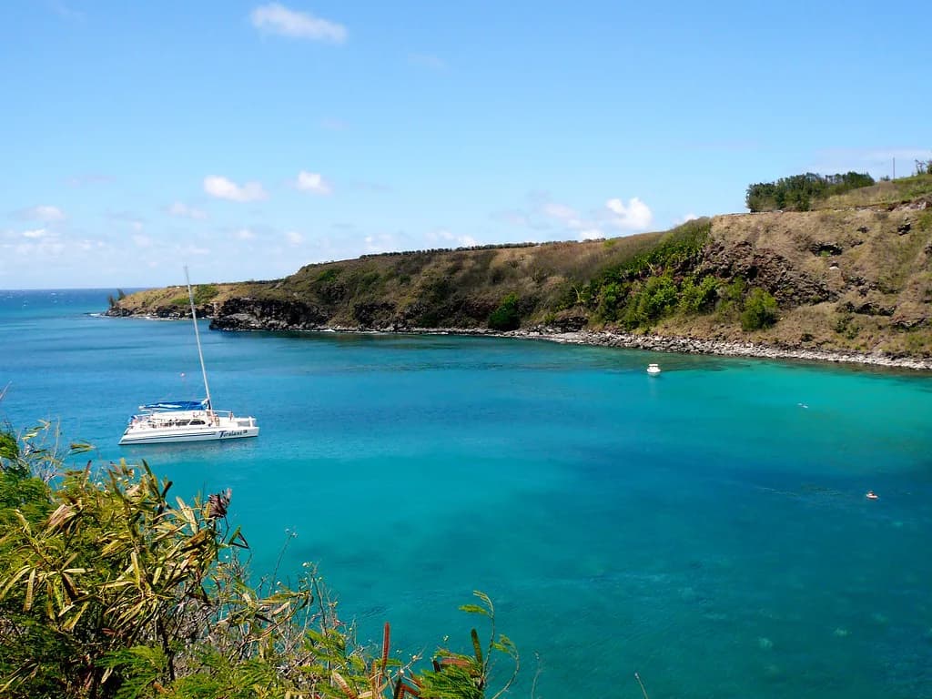
Honolua Bay packs a full morning of reef into a single protected pocket on West Maui's north shore, with coral on both sides of the bay and a boulder beach that keeps the crowds down. It suits snorkelers who are comfortable swimming a few hundred feet before the good coral appears, and who want turtles, schooling tangs and spur-and-groove formations without a boat ride.
The trade-off is that this is not a step-off-the-sand reef. The bay is large, the shoreline is rocky, and the first stretch of water is often murky where the stream enters. Plan the entry point and the swim route before you park, and the day runs smoothly.
Why Honolua Bay Is Worth the Hike
Honolua Bay sits inside the Honolua-Mokule'ia Bay Marine Life Conservation District, so fishing and removal of marine life and even rocks are prohibited. That protection is the reason the reef stays lively close to shore, with dense fish schools and coral in decent health alongside patches of dead coral.
The bay also stays surprisingly calm when trade winds chop up the coastline elsewhere, which makes it a useful fallback on windy days. In winter, north swell can turn the same bay into one of Maui's best surf breaks, so the season changes what you get.
Expect a short forest walk to reach the water, a boulder beach rather than a sand lounging beach, and a swim before the reef begins. If you want a shorter, sandier introduction to Maui snorkeling, compare this bay with calmer west-side options before committing.
Where the Bay Sits on West Maui
Honolua Bay lies off Honoapiilani Highway (Highway 30) near mile marker 32, past Kapalua on the drive north from Lahaina. Coming from Kihei, follow Highway 30 north past Lahaina, Ka'anapali and Kapalua until the road bends back toward the water.
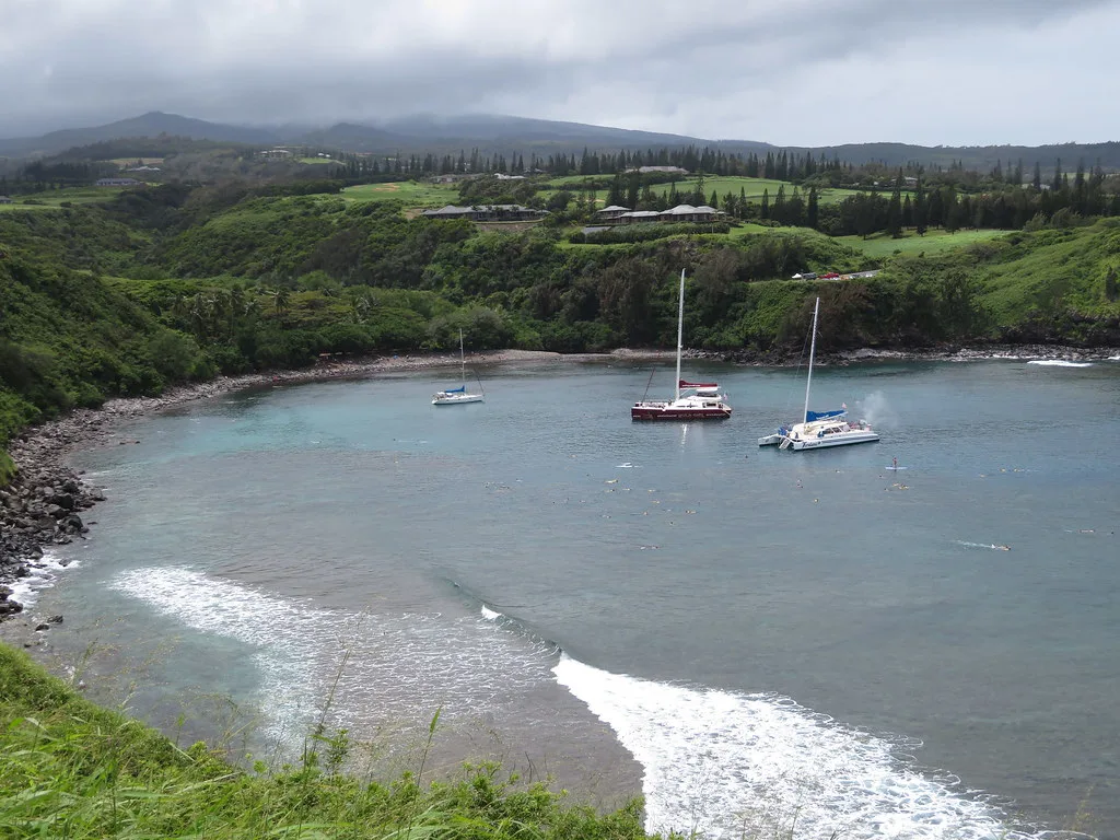
Watch for a turnout on the bluff with a green chain-link fence just past the mile marker; that is Slaughterhouse Beach. The next large turnout overlooks Honolua Bay itself, and cars begin parking along the road as it drops downhill before the left-hand curve.
Getting Down to the Beach
Two trails lead from the road to the bay, and both are essentially flat with a stream crossing to wade. The first trailhead sits near the first bend past the overlook, where a gate blocks an old dirt driveway; from there it is about 700 feet to the beach.
The second trailhead is just past the next big left bend, behind the parking area with the porta-potties, and runs about 1,500 feet to the beach. Sandals or flip-flops handle either path fine, since neither involves real climbing.
Water Entry: Sand on the Left, Rocks on the Right
Most people enter on the left side of the boulder beach because a patch of sand makes it easier. The catch is the Honolua Stream, which empties into the bay on that same side and can leave visibility so poor you cannot see your feet until you are well offshore.
The better call on a murky day is to walk along the rocks to the right, past the old boat ramp, and enter there. The rounded boulders can be slick with algae, so wear shoes for this route rather than going barefoot.
A diver's sign at the top of the cement boat ramp explains the reserve and is worth reading before you get wet. Treat the ramp and the rocks beside it as the default entry when the stream is running.
How Far Out the Reef Is
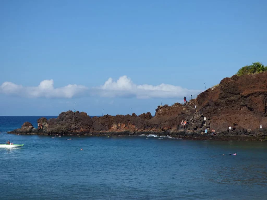
From the entry, swim near the rocky shore on the right until the reef appears, roughly 600 feet from the beach. The bottom on the way out is mostly sand with scattered fish, and catamarans often drop snorkelers directly over the first coral.
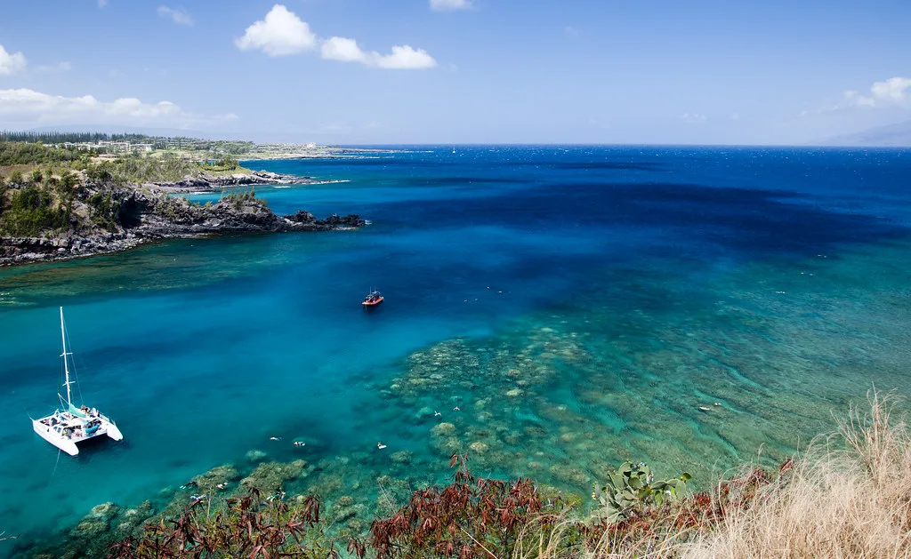
Once you reach it, the right-side reef runs for about another 700 feet along the bay, with coral in spur-and-groove formations that come near the surface and rarely drop below 15 feet. That shallow profile means good light and long bottom times for anyone comfortable with the swim out.
The Right Side: Fish, Turtles and Sand
The right-side reef is where the fish variety shows up quickly: large schools of convict tang, butterflyfish in several species, parrotfish, triggerfish including the humuhumunukunukuapua'a, and moray eels tucked into the coral. Over the sand near the beach, bigeye scad gather in big schools.
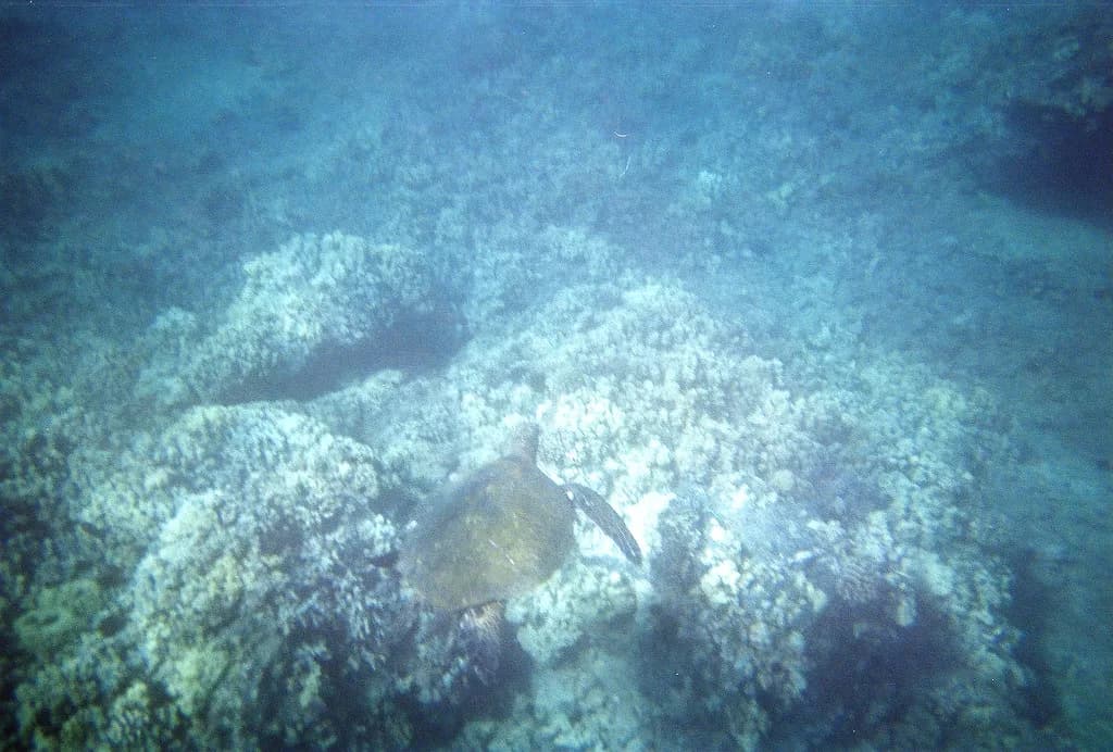
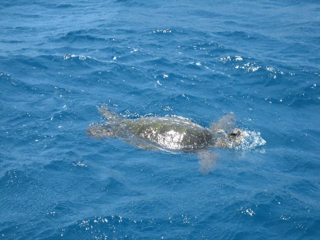
Green sea turtles turn up regularly here, often in the shallower coral and over sand patches. Keep the published distance from them, never chase or touch an animal, and let the turtle set the pace of any encounter.
Crossing the Bay to the Left Side
Between the two reefs lies open water, and crossing takes about 400 feet over a sandy bottom that reaches roughly 50 feet deep. In clear conditions you can follow the bottom; in murky water the crossing is a compass-line swim to the rocky point on the far side.
Avoid the zone near the mouth of the bay where the surf breaks; start the crossing before you reach that line. Strong swimmers can combine both sides in one outing, while less confident snorkelers should treat the crossing as optional.
The Left Side and Kalaepiha Point
The west, left-hand side is often rated the better snorkeling side, following the rocky shoreline out and around Kalaepiha Point. Near shore the structure is more rock than coral, with large shelves, channels, caves and big boulders that create interesting underwater terrain.
The reef on this side stretches about 500 feet and runs from near the surface down to about 20 feet, so it rewards a slow, close pass rather than a fast swim. Divers favor this side for its deeper coral formations.
On the return leg you have another long sandy stretch back to the beach. If visibility drops, cross back toward the boat ramp and exit where you entered.
What You Will See
Beyond the schooling tangs and butterflyfish, expect sergeant majors, surgeonfish, wrasses, goatfish, chubs, coris and trumpetfish, plus sea cucumbers and several kinds of urchin on the rock. The coral mix includes finger, lobe, mound and rice varieties, some healthy and some dead.
Treat every sighting as likely rather than promised: visibility, swell and rainfall all shift what shows up on a given morning. For a completely different reef experience on the same island, Molokini Crater snorkeling offers a boat-accessed crater with its own character.
Skill Level and Who It Suits
Honolua Bay works best for snorkelers who are comfortable swimming several hundred feet from shore and can handle a rocky entry. Beginners and kids can enjoy the shallow right-side reef, but only with a confident adult alongside and a plan to skip the deep crossing.
Because the bay is big, splitting the day into two swims works well: one side before lunch, the other after. That pacing also gives your legs a rest between the long entries and exits.
Best Time of Year and Time of Day
Summer and early fall usually bring the calmest water, when the bay can go flat and visibility improves. Winter north swell can make the bay a surf break instead of a snorkel site, so look at a swell forecast before driving up.
Heavy rain is the other deal-breaker, because runoff through the stream can wreck visibility on the left side for days. Morning tends to be the calmer, less crowded window before tour boats and afternoon wind arrive.
When wind or swell shuts the north shore down, check current Maui snorkeling conditions and shift to a sheltered west-side bay rather than waiting it out.
Hazards to Plan Around
The entry rocks are rounded and algae-slick, so footwear matters more here than at a sand beach. Inside the bay, watch for the surf line near the mouth, boat traffic from catamarans dropping snorkelers, and the deep, featureless water of the mid-bay crossing.
There are no lifeguards at the bay, so snorkel within your own limits and keep a buddy in sight. Check the day's advisories with Hawaii's DLNR before you commit to the drive.
Parking and Facilities
Parking is limited to roadside turnouts around the bay, and spaces fill quickly on calm mornings. The turnouts are also a known target for break-ins, so carry valuables with you and leave nothing visible in the car.
Facilities are minimal: porta-potties stand near the second trailhead parking area, and a food truck across the street has sold smoothies, lunch and cold drinks. There is no beach shower or restroom building at the water.
Rules in the Marine Reserve
Honolua Bay is a Marine Life Conservation District, which means no fishing and no taking of any natural resources, including marine life and rocks. Read the reserve sign at the boat ramp so the boundaries and restrictions are clear before you swim.
Maui requires reef-safe mineral sunscreen, so choose a mineral formula or cover up with a rash guard instead. Apply sunscreen well before entering the water to reduce what washes off onto the coral.
What to Bring
Bring shoes you can walk wet rocks in, a rash guard for sun and warmth, water, and a light pack for the trail in. A thin full-length suit or skin cuts sunscreen use and adds protection on the long swims.
Pack light because you may be walking more than a quarter mile from the car, and plan to carry everything back out with you. A dry bag keeps valuables with you rather than in the vehicle.
Nearby Spots to Combine
Slaughterhouse Beach sits just up the road near the green chain-link fence turnout, and DT Fleming Beach Park is close by on the same drive. Both make easy add-ons before or after a Honolua swim, though each has its own entry and swell exposure.
If you want a gentler entry and a beach to set up on, Kapalua Bay snorkeling a few miles south offers a different, sandier day. Black Rock Maui snorkeling near Ka'anapali is another option on the drive back toward Lahaina.
Plan Your Honolua Bay Snorkel Day
Honolua Bay gives you a protected reef on both sides of a big bay, but the day hinges on two decisions: enter over the rocks past the old boat ramp if the stream is murky, and swim the 600 feet out before judging the visibility. Confident swimmers get the full loop; beginners should stay on the right side and skip the deep crossing. If you are weighing this against a trip to another island, this comparison of snorkeling in Oahu shows how a different coastline changes the entry and swim plan.
Go on a calm summer or fall morning, check the north swell forecast first, and park with everything valuable on your back. Time it right and the long swim pays off with turtles, schooling tangs and spur-and-groove coral in a reserve that keeps the reef alive.
Frequently Asked Questions
Is Honolua Bay good for snorkeling?
Yes, for snorkelers who accept a swim. The bay is a protected marine life conservation district with coral on both sides, and the right-side reef begins roughly 600 feet from the beach. Visibility on the left near the stream can be poor, so plan your entry accordingly.
How do I get to the beach at Honolua Bay?
Park in the roadside turnouts off Honoapiilani Highway near mile marker 32, then walk one of two flat trails. The first is about 700 feet from a gate near the first bend; the second, behind the porta-potty parking area, is about 1,500 feet. Both involve wading the stream.
How far do you swim to reach the reef at Honolua Bay?
Plan on about 600 feet from the beach to the first coral on the right side. The reef then runs another 700 feet or so, and crossing to the left side adds roughly 400 feet over water up to 50 feet deep. Strong swimmers can link both sides; others should pick one.
Do you need reef shoes at Honolua Bay?
Yes, footwear helps. The beach is made of rounded boulders that can be slick with algae, and the preferred entry past the old boat ramp is over rock. Sandals with grip or closed-toe water shoes make the walk in and the entry safer than bare feet.
Is Honolua Bay suitable for beginner snorkelers?
Beginners can enjoy the shallower right-side reef with a confident adult, but the long swim out and the deep mid-bay crossing favor experienced snorkelers. Beginners should skip the crossing, stay closer to the right shore, and treat the reef edge as their turnaround point.
When is the best time of year to snorkel Honolua Bay?
Summer and early fall typically bring the calmest water and best visibility. Winter north swell can turn the bay into a surf break, so check a swell forecast before driving up. Heavy rain also muddies the left side through stream runoff.
Are there facilities or lifeguards at Honolua Bay?
Facilities are minimal: porta-potties near the second trailhead parking area, and a food truck across the street has sold smoothies and lunch. There are no lifeguards at the bay, so snorkel within your limits and keep a buddy in sight.
Can you snorkel Honolua Bay in winter?
Sometimes, but winter is when north swell can make the bay a surf break rather than a snorkel site. On calm days between swells the reef is still there, but check the swell forecast first and have a sheltered west-side backup ready.
Sources
Snorkeling notes for your next trip
Optional updates to our snorkeling guides.
You might also like
Continue reading
More guides you'll find useful